
Nearing the Little Su Bridge

Nearing the ol' Motherlode Lodge, elevation about 1500'

From the Gold Mint Trail parking lot, looking on up the road I'm about to take.

Hmm, just a bit hazy down there in the Valley.

Anyone need a snow fix? There's still plenty in this area.


Looking toward Independence Mine. Yep, lots of snow...

Looking in about the opposite direction of the last shot, showing Willow-Fishhook Road in lower right and the mountains. W-F'hook isn't open yet, but I've heard they're working on it and it should be open to vehicle travel soon.

In the parking lot just above the Lodge, a view down into Mat-Su Valley. Weirdly enough, the view was clearer to the eye but the glacier dust in the air left many of my pix slightly hazy looking, even a couple I did with the tripod.

Ol' manager's house up at the mine, now the gift shop.

A closer look at some of the old mine buildings.

Heading back down the pass. As you can tell, it hasn't green-ed up much but in a couple weeks that will change, I'm sure.

I didn't stop on the way in but couldn't resist a quick stop on the way out at the viewing platform over the Little Su. How many hundreds of photos do I have of this almost identical view? Ha

Through the water at the rocks.

Interesting. Shows where you are, at the bottom of the map, and where the river comes from in relationship to the Mine and Pass.

Part of the info with the map


 Nearing the Little Su Bridge
 Nearing the ol' Motherlode Lodge, elevation about 1500'
 From the Gold Mint Trail parking lot, looking on up the road I'm about to take.
 Hmm, just a bit hazy down there in the Valley.
 Anyone need a snow fix? There's still plenty in this area.
 Looking toward Independence Mine. Yep, lots of snow...
 Looking in about the opposite direction of the last shot, showing Willow-Fishhook Road in lower right and the mountains. W-F'hook isn't open yet, but I've heard they're working on it and it should be open to vehicle travel soon.
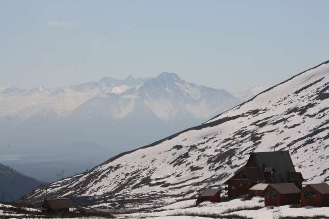 In the parking lot just above the Lodge, a view down into Mat-Su Valley. Weirdly enough, the view was clearer to the eye but the glacier dust in the air left many of my pix slightly hazy looking, even a couple I did with the tripod.
 Ol' manager's house up at the mine, now the gift shop.
 A closer look at some of the old mine buildings.
 Heading back down the pass. As you can tell, it hasn't green-ed up much but in a couple weeks that will change, I'm sure.
 I didn't stop on the way in but couldn't resist a quick stop on the way out at the viewing platform over the Little Su. How many hundreds of photos do I have of this almost identical view? Ha


No comments:
Post a Comment